Petra Schulz · 19 September 2026
Nighttime Ecosystem Mapping Through Bioluminescent Signal Analysis in Isolated Coastal Zones
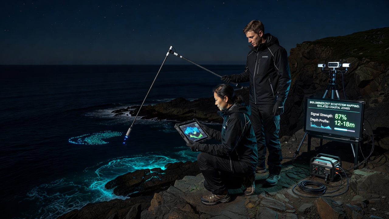
Isolated coastal zones present unique challenges for ecological study because darkness limits traditional observation methods yet many marine organisms produce natural light through bioluminescence, and scientists now use this phenomenon to map ecosystems after sunset. Researchers collect light emissions from plankton, fish, and invertebrates to identify species distributions and track environmental changes without disturbing habitats during daylight hours. Data gathered through signal analysis reveals patterns in organism density, migration routes, and responses to temperature shifts or nutrient levels.
How Bioluminescent Signals Form the Basis for Mapping
Organisms in these zones emit light through chemical reactions involving luciferin and luciferase enzymes, and the intensity and wavelength of each flash provide measurable data points that correspond to specific species or community types. Experts deploy underwater cameras and photomultiplier tubes along remote shorelines to record these emissions continuously throughout the night, then process the recordings with software that converts light patterns into spatial maps. Studies conducted in Pacific island chains have shown that certain dinoflagellate blooms produce rhythmic pulses every few seconds, allowing analysts to estimate population sizes from signal frequency alone.
Equipment calibration remains essential because ambient moonlight and starlight can interfere with faint biological signals, so teams filter recordings to isolate wavelengths between 450 and 500 nanometers where most marine bioluminescence occurs. In September 2026 a multi-institution project coordinated by Australian marine laboratories plans to release updated calibration protocols that account for seasonal lunar cycles in southern hemisphere coastal sites.
Technologies Driving Signal Collection and Interpretation
Autonomous underwater vehicles equipped with low-light sensors now traverse isolated bays and fjords where human access proves difficult, and these platforms transmit real-time data via satellite links to shore-based analysis centers. Software algorithms distinguish between steady glows from bacterial mats and rapid flashes from schooling fish by measuring duration and repetition rates, which improves species identification accuracy. According to reports from the National Oceanic and Atmospheric Administration, such vehicle surveys have documented bioluminescent hotspots along the Alaskan coastline that correlate with upwelling zones rich in nutrients.
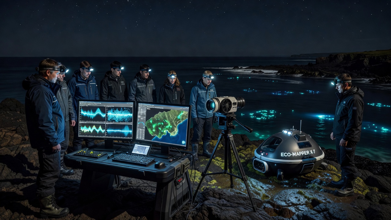
Integration with acoustic sensors adds another layer because sound patterns from marine mammals often coincide with bioluminescent events triggered by their movement through plankton layers. Analysts cross-reference light and sound datasets to build three-dimensional models of nighttime activity that extend from surface waters down to depths of 200 meters in some locations. Research teams working in the Norwegian fjords have combined these datasets to track how herring schools alter their vertical distribution when bioluminescent prey concentrations change.
Applications in Conservation and Environmental Monitoring
Mapping outputs help authorities identify areas where artificial lighting from nearby developments disrupts natural light cycles, and managers then adjust coastal infrastructure to reduce interference with breeding or feeding behaviors. In one documented case along the Tasmanian coast, signal analysis revealed a decline in certain jellyfish populations that coincided with increased sediment runoff, prompting targeted restoration of upstream wetlands. European marine agencies have adopted similar approaches to monitor protected zones around the Canary Islands, where data shows seasonal shifts in bioluminescent activity tied to water temperature variations.
Long-term datasets accumulated over multiple seasons allow comparison between years and detection of trends linked to broader climate patterns, while short-term deployments capture immediate responses to events such as storms or algal blooms. Observers note that isolated zones often serve as reference sites because they experience fewer direct human impacts, making changes in bioluminescent output easier to attribute to natural drivers rather than local pollution.
Challenges in Data Processing and Interpretation
High volumes of raw light recordings require substantial computational resources for filtering and classification, and researchers continue to refine machine-learning models trained on verified species libraries. Variations in water clarity affect signal propagation because suspended particles scatter light and reduce detection range, so teams incorporate turbidity measurements into every survey. Collaboration between institutions in Canada and New Zealand has produced open-source tools that standardize these corrections across different coastal environments.
Validation against traditional sampling methods remains necessary even though bioluminescent analysis reduces physical disturbance, and divers periodically collect specimens to confirm that mapped signals match actual organism presence. Such cross-checks strengthen confidence in the remote sensing approach and support wider adoption by regulatory bodies responsible for coastal management.
Conclusion
Nighttime ecosystem mapping through bioluminescent signal analysis supplies detailed information about isolated coastal zones that daytime surveys cannot capture, and ongoing technological improvements continue to expand the precision and geographic reach of these methods. Data from multiple regions demonstrate consistent correlations between light patterns and ecological variables, while coordinated projects scheduled for 2026 aim to standardize protocols further. Continued collection and analysis of these signals will support evidence-based decisions for habitat protection and resource management in sensitive marine areas.